Media Operations

Collapse All Expand All
 How do I get a flight with the Hurricane Hunters?

STORM OPERATIONS

Only media members who are already part of our active media pool may fly during a storm mission.

Don't delay, as flights fill up quickly when storms are already approaching land. Only three media outlets may fly at a time.

Please limit the number of people you send to two.

For more information, contact 403wg.pa2@us.af.mil.

 I have a flight scheduled. What equipment should I bring?
  • Spare batteries
    • There are no power sources for charging on the aircraft
  • Small remote microphone (peanut / lapel)
    • A headset is available for media (may have to share with other media)
    • Average sound in side aircraft in flight is 110 decibels -- headset is the only way to be heard/understood
    • Handheld microphone works well for you to provide commentary without interrupting crew.
    • Camera-mounted mics do not work as well as hand-helds
  • ​Wide-angled lens for shooting the Hurricane Eye
    • Not all hurricane eyes are well-formed for that "stadium effect"
    • Excellent video has been achieved with an action camera up against a window with a suction cup

NOTE:

  • ​Polarizing lenses have been known to pick up interference from our windows, so beware "rainbows"
  • Radio-transmitting (wireless) mics have been known to fail inflight, possibly due to interference with aircraft radios.
    • Cables are safest to avoid interference
  • ​If any of your equipment interferes with the aircraft' s electronic systems, you'll be advised to stop operation.
 Tips for Media Travel

Official members of the media may be permitted to fly a storm mission by contacting the 403rd Wing Public Affairs office at (228) 377-2056 during normal office hours (8 a.m.- 4 p.m. CST).

Media interested in flying an upcoming or active storm mission should contact PA immediately, as slots fill up quickly. Up to three media outlets may fly at a time. To film a training (non-storm) flight, allow up to two to three weeks for coordination.

Media members must submit a request letter on company letter head signed by their outlet’s publisher or editor. The letter must include the names and contact information of the reporters, photographers or videographers requesting to fly, the product they plan to produce, and the projected publication or air time. Send the letter to 403WG.PA2@us.af.mil.

Transportation Rules:

  • Media must secure their own transportation to/from Keesler or other designated airbase.
  • There is no guarantee a mission will land at the same base from which it departed. Often this is known ahead of time but is not always the case. If a mission lands at an alternate base, media must secure their own transportation from there.
  • Media interested in flying missions outside the Continental United States must coordinate with PA to secure special permission from the foreign desk in Washington.

Liability:

  • Despite a good safety record, all mission passengers must sign a standard release form prior to boarding the flight.
  • Flying through thunderstorms sometimes involves severe turbulence, hail and lightning, but not always.

Medical:

  • Media and other passengers with head colds should not fly missions due to the danger of an ear or sinus block.
  • Epileptics have suffered seizures in flight.
  • All media should consult a physical if any medical concerns exist.
  • Medication, to include aspirin, decongestants and airsickness pills, are not stocked on flights. Those in need of medication should carry their own.
  • Most passengers do not suffer airsickness, but if anyone flying as a passenger should speak with a crewmember immediately if they feel sick. While airsickness bags are passed out at the beginning of each flight, they are not expected always to be used.

Hydration:

  • Dehydration is a serious concern in the hot/humid climates in which missions are flown, and is compounded by dry air inflight.
  • Passengers should restrict alcohol, coffee, or sugar-laden drinks prior to and during flight. Water is the best choice and should be drunk prior to take-off.

Food:

  • A light meal is recommended prior to flight -- stomachs with food generally are more stable during flight.
  • Passengers should bring their own meals for the 10-12 hour flights.
  • Coffee and water is available, as well as a small convection oven for heating up TV dinners, though it will sometimes not work. A hot pot to boil water for soups, tea and more is available. There is no refrigeration on board, so all food should be non-perishable or in a cooler with ice.

Clothes:

  • Passengers should wear comfortable clothes
    • Flat, comfortable shoes or boots
    • Sunglasses for viewing storm out window
    • Dress in layers for the high-altitude flight to/from the hurricane
    • Bring enough funds, personal items, professional equipment to be self-sufficient for several days
    • Pillow for nap

Special consideration for Winter Storm flights: Think cold, not tropical, when dressing for a winter storm flight. Long pants and consider some long underwear. It is -50F up at altitude. The aircraft is not always well insulated, especially near the floor. Dress in layers, and pay attention to your feet. There are parts of the airplane that are colder than others, but be prepared to spend some time in a colder section.

Arrival Instructions:

  • Arrive a minimum two hours prior to takeoff; earlier to record the permission briefing
  • Arrival location and time will sent to media during coordination.
  • For travel planning, the nearest airports are:
    • Gulfport-Biloxi Regional (30 min)
    • New Orleans, LA (90 min)
    • Mobile, AL ( 1 hr)

Media Escort:

  • An escort will be assigned to media to arrange time to visit the flight deck (turns may be taken), coordinate crew to answer questions and be a go-between.
  • Most escorts have experienced several hurricane flights and will be available to answer questions when the crew is busy.

CAVEAT:

  • Hurricane Hunter crew cannot make forecasts or predictions as to storm behavior.
  • Hurricane specialists at the National Hurricane Center use Hurricane Hunter weather data, in addition to numerous other sources and complex computer models, to make those forecasts. No single flight provides the breadth of understanding of any given storm to extrapolate future behavior. Storms fluctuate in strength and sometimes wobble in their paths. Those NHC experts use HH feedback to make storm predictions and inform decision makers. Refer to their reports for projections.

Live Feeds:

  • While not recommended, live, audio-only interviews via HF-radio phone patch may be possible inflight, though timing must be flexible. Media may schedule several potential windows of time as patches may not be possible due to crew requirements at any given time during the mission, poor atmospheric conditions, heavy rains or other air traffic using the designated radio frequency.
  • Also, such use of the radio frequency must be short due to other aircraft needing to use them.
  • Sound quality is often poor due to atmospheric conditions.

Pool Footage

  • In the past, media organizations have arranged to gain footage shot by other media organizations inflight. This must be coordinated between agencies.
  • PA does not maintain public domain footage, though it may provide a list of previous media orgs who have flown HH missions who might be willing to share.

The Finished Product

  • A copy of any article or audio or video product will be requested for archival purposes.
  • Upon receipt, PA will send an authentic "Hurricane Hunter" certificate to the media.

Unit Status

53rd Weather Reconnaissance Squadron
"Hurricane Hunter"

PLAN OF THE DAY

Tasked storm flights

Stock imagery and video

Hurricane Hunters

Collapse All Expand All
 About

Since 1946, the Hurricane Hunters have been collecting data inside the strongest storms on earth. These Citizen Airmen send the data collected directly via satellite communications to the National Hurricane Center in Miami. The Hurricane Hunters fly the state-of-the-art, WC-130J aircraft, which enables the Hurricane Hunters to collect the most accurate and detailed data possible.

Despite the dramatic blow in August, 2005, from Hurricane Katrina, which devastated the “Hunter’s” own home base and local communities along the Mississippi Gulf Coast, these reservists never missed a mission. They flew more than 1,500 hours into storms beginning in mid-May with Hurricane Adrian in the Pacific and finally ended in early December flying missions into Hurricane Epsilon.

The Hurricane Hunters also collect data on winter storms and are qualified to fly tactical airlift missions. 

 Watch
 Mission

The primary mission of the 53rd Weather Reconnaissance Squadron is to conduct tropical storm reconnaissance. The 53rd WRS is aligned under the 403rd Airlift Wing, and Air Force Reserve Command unit located at Keesler Air Force Base, Mississippi. Although the airplanes and people are Department of Defense assets the unit's “primary tasking” command is the Department of Commerce. Tropical reconnaissance is governed by the National Hurricane Operations Plan. This plan specifics that the 53rd WRS will support 24 hour a day continuous operations and have the ability to fly up to 3 storms at a time with a response time of 16 hours. I am sure you are thinking, 3 storms a day, that would never happen! Well, our AOR is not just the Caribbean and the Atlantic it actually extends from the Mid-Atlantic (55W Longitude) to the International Dateline in the Pacific.


Since the 53rd WRS is tasked to fly three storms, twice a day, there is a necessity for 10 full-time aircrews and 10 part-time. Many of the part-timers are part of the civilian work force and hold a wide array of jobs including airline pilots, school teachers, realtors ... you name it.

They come to the base a couple of times every month to train and will fly recon missions when available. The 53rd WRS flies the WC-130J with a five-person crew element to include a pilot, co-pilot, navigator, aerial reconnaissance weather officer, and a weather loadmaster.

Low Level Investigation:

When a storm is beginning to form, the NHC will send the 53rd WRS to investigate whether the winds are blowing in a counterclockwise rotation therefore indicating a “closed system”. This mission is flown from 500 - 1500 feet above the ocean surface; the ARWO will constantly monitor the ocean waves in order to determine the wind speed and direction from the sea state. The low-level wind and pressure fields will provide an accurate snapshot for the Hurricane Center Forecasters. Once it is determined that there is a circulation within the disturbance, the mission will transform into a “fix” mission.

Fix Mission:

The “fix” mission is where the ARWO will direct the crew to the true center of the storm. In order to get a good overall look at the storm the unit flies the storm using an alpha pattern (see image below), which consists of intercardinal headings with legs 105 nautical miles in length. This alpha pattern is repeated two times during one mission.

During flight, weather data is continuously collected and sent directly to the NHC via satellite communications. Since the WC-130J is not equipped for aerial refueling, the alpha pattern will continue until “bingo” fuel is reached or the NHC has received all the information it needs. A 53rd WRS aircrew will enter major hurricanes (category 3 or above) at 10,000 feet. While penetrating the eyewall, a weather instrument, called a dropsonde, is released to determine the maximum winds at the surface and than another “sonde” is released in the eye to detect the lowest pressure at the surface. After exiting the eye the ARWO creates a vortex message that includes the exact latitude and longitude of the center as well as maximum winds, maximum temperature and minimum pressure.

Sondes collect the same vertical data that weather balloons over land do just they go down instead of going up. This instrument gathers weather data including wind direction and speed, pressure, temperature, and humidity from the planes altitude to the waters surface creating a vertical profile of the atmosphere.


Why they do what they do:

So, why do they do this? The impact of hurricane hunter data is drastic – up to 30 percent more accurate according to the NHC. The 30 percent metric sounds great, but what does it really mean to the public and the government? Below was a four-day forecast issued by the NHC of Hurricane Ivan with the white bubble indicating their margin of error in the forecast. Without recon data the forecast would have a margin of error similar to the red bubble and with the estimated cost to evacuate one U.S. coastal mile at one million dollars the savings can be enormous. Indirectly, the Hurricane Hunter’s data save lives. Since people believe the forecast, they heed warning areas and evacuate the affected areas. Without the only operational hurricane reconnaissance unit in the world flying into storm every season, the negative impact on forecast accuracy could be devastating.


Buoy Drops:

A mission we are sometimes tasked to do during the hurricane season is dropping various weather buoys in the path of oncoming hurricanes and tropical storms. We load the required buoys on the aircraft and drop the buoys via parachute at predetermined locations. It's an exciting mission as we don't often get to open the back of the plane up in flight!

Winter Storm Mission:

So, what do the Hurricane Hunters do in the winter? The 53rd WRS also collects data for winter storms which has proven to be very valuable to the National Weather Service. The goal is to release the dropsonde as high as possible in the atmosphere and ahead of the storm extending the network of weather data over the water. This data drastically increases the accuracy of computer weather forecasts for nor’easters and pacific winter low pressure systems. The Hurricane Hunters use the month of February to fly Pacific storms from Elmendorf AFB, Alaska or Hickam AFB, Hawaii.

Research Missions:

Many people know that both the 53rd WRS and NOAA perform flights into tropical systems. One of the biggest differences between these missions is that the 53rd WRS usually collects data for operational meteorology use while NOAA flights are usually for research use. But occasionally the 53rd WRS does get to do research missions as well. The research missions the 53rd WRS does are similar to the storm flights they perform, launching instruments like sondes and buoys into tropical or mid-latitude systems to collect data for research meteorologists.
 

 Weapon System - WC-130J

The 53rd WRS uses the WC-130J to penetrate tropical storms. These aircraft are not reinforced in any way. In fact, the only differences between a WC-130J and a C-130J is the addition of two external fuel tanks (giving them longer range), a radiometer pod on the left wing, and the two additional crew pallets in the cargo bay.

The C130J is the newest generation of the C-130 Hercules which primarily performs the tactical portion of the airlift mission. The aircraft is capable of operating from rough, dirt strips and is the prime transport for air dropping troops and equipment into hostile areas.

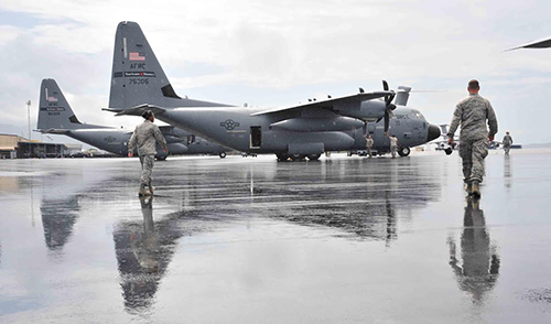
The C-130 operates throughout the U.S. Air Force, serving with Air Mobility Command (stateside based), Air Force Special Operations Command, theater commands, Air National Guard and Air Force Reserve Command, fulfilling a wide rage of operational missions in both peace and war situations. Basic and specialized versions of the airframe perform a diverse number of roles, including airlift support, Antarctic ice resupply, aeromedical missions, weather reconnaissance, aerial spray missions, fire-fighting duties for the U.S. Forest Service and natural disaster relief missions.

Features:

Using its aft loading ramp and door the C-130 can accommodate a wide variety of oversized cargo, including everything from utility helicopters and six-wheeled armored vehicles to standard palletized cargo and military personnel. In an aerial delivery role, it can airdrop loads up to 42,000 pounds or use its high-flotation landing gear to land and deliver cargo on rough, dirt strips.

The flexible design of the Hercules enables it to be configured for many different missions, allowing for one aircraft to perform the role of many. Much of the special mission equipment added to the Hercules is removable, allowing the aircraft to revert back to its cargo delivery role if desired. Additionally, the C-130 can be rapidly reconfigured for the various types of cargo such as palletized equipment, floor-loaded material, airdrop platforms, container delivery system bundles, vehicles and personnel or aeromedical evacuation.

The C-130J is the latest addition to the C-130 fleet and will replace aging C-130E's. The C-130J incorporates state-of-the-art technology to reduce manpower requirements, lower operating and support costs, and provides life-cycle cost savings over earlier C-130 models. Compared to older C-130s, the J-model climbs faster and higher, flies farther at a higher cruise speed, and takes off and lands in a shorter distance. The C-130J-30 is a stretch version, adding 15 feet to the fuselage, increasing usable space in the cargo compartment.

C-130J/J-30 major system improvements include: advanced two-pilot flight station with fully integrated digital avionics; color multifunctional liquid crystal displays and head-up displays; state-of-the-art navigation systems with dual inertial navigation system and global positioning system; fully integrated defensive systems; low-power color radar; digital moving map display; new turboprop engines with six-bladed, all-composite propellers; digital auto pilot; improved fuel, environmental and ice-protection systems; and an enhanced cargo-handling system.

Background:

Four decades have elapsed since the Air Force issued its original design specification, yet the remarkable C-130 remains in production. The initial production model was the C-130A, with four Allison T56-A-11 or -9 turboprops. A total of 219 were ordered and deliveries began in December 1956. The C-130B introduced Allison T56-A-7 turboprops and the first of 134 entered Air Force service in May 1959.

Introduced in August of 1962, the 389 C-130E's that were ordered used the same Allison T56-A-7 engine, but added two 1,290 gallon external fuel tanks and an increased maximum takeoff weight capability. June 1974 introduced the first of 308 C-130H's with the more powerful Allison T56-A-15 turboprop engine. Nearly identical to the C-130E externally, the new engine brought major performance improvements to the aircraft.

The latest C-130 to be produced, the C-130J entered the inventory in February 1999. With the noticeable difference of a six-bladed composite propeller coupled to a Rolls-Royce AE2100D3 turboprop engine, the C-130J brings substantial performance improvements over all previous models, and has allowed the introduction of the C-130J-30, a stretch version with a 15-foot fuselage extension. Air Force has selected the C-130J-30 to replace retiring C-130E's.

General Characteristics of the Hurricane Hunters WC-130J:

The Weather Pallets:

In the cargo department are two pallets used exclusively for the weather mission; the ARWO and dropsonde/loadmaster pallet.

The ARWO Pallet:

The ARWO pallet consists of a computer system that processes all the atmospheric data it collects from the airplane’s sensors, a radio and satellite control for communication purposes (only data capable), and interphone control and flight deck representations.

The Weatherbird Software:

The Weatherbird data collection software enables the ARWO operator to monitor atmospheric conditions, both numerically and graphically, near the WC-130J and transmit this data to monitoring stations on the ground. Atmospheric and aircraft flight data are sampled once per second at flight level and averaged into 10-second data sets by the ARWO computer. The software then uses the 10-second data to compute numerous higher level meteorological parameters, such as pressure, altitude, temperature, and dew point, all of which can be displayed and stored. The 10-second data is averaged into 30-second averages, which are then formulated into data messages, called High Density Observations each containing 10 minutes worth of information. The HDOBS are automatically sent to the National Hurricane Center in Miami via satellite communications, where they are fed directly into the NHC computers and are instantly available to hurricane forecasters as analysis and forecasting tools.

Finally, the software serves as a storage and transmission facility for data messages. Vertical sounding messages (referred to as DROPs) are produced by AVAPS (see below for more information), while horizontal observations (referred to as RECCO) and Vortex Data Messages are produced by the Weatherbird software. RECCO messages contain both sensed and subjective data collected by the ARWO at flight level, while VDMs are hurricane eye reports of location and intensity. All messages can be retrieved, edited and restored by the ARWO and finally sent to the customer via the satellite communication system. Plain language "administrative" messages can also be sent via satellite communications, enabling direct and fast communication between the mission ARWO and forecasters at the National Hurricane Center.

The Communication Navigation Identification Unit (CNIU):

Aircraft position and flight-level wind information is provided to the ARWO data system by the aircraft mission computer. The global positioning system navigation unit can pinpoint a position accurately to less than one mile after an average 10-hour hurricane reconnaissance mission. This position and wind data is included in the HDOBS messages.

The mission ARWO can manipulate the stored data in a variety of ways. It can be displayed in various digital formats or graphically depicted in time series or position plots. The speed and flexibility with which data can be viewed aid the ARWO's analysis and decisions, dramatically improving the ability to maintain control of the mission in the rapidly changing environment of a hurricane.

The Satellite Communication System (SATCOM):

The SATCOM consists of an onboard transceiver and antenna, plus a reciprocating station located on the ground. There are currently two operational ground stations; one at the National Hurricane Center and the other at Keesler Air Force Base, Miss. Messages passed are automatically displayed on the respective receiving station's computer monitor. An acknowledgment of receipt of a message is automatic and is instantaneously relayed to the sending station by the receiving station. This enhances the book keeping process by the ARWO on the aircraft and ensures that none of the critical hurricane reconnaissance data is lost in space.

The Airborne Vertical Atompsheric Profiling System (AVAPS) Pallet:

The Advanced Vertical Atmospheric Profiling System helps provide the complete structural picture of a storm. AVAPS is a self-contained vertical atmospheric profiling system, installed in two standard 19-inch racks, that records current atmospheric conditions vertically below the WC-130J aircraft as a deployed sonde falls to the surface. AVAPS consists of expendable sondes, a Dropsonde Telemetry Chassis, high power computer, and a color monitor.

The GPS Dropsonde:

The GPS dropsonde is a lightweight instrument package that is launched from the WC-130J aircraft. As it descends from aircraft altitude (5,000 - 38,000 feet) to the surface, at about 2,500 feet per minute, it measures and transmits current pressure, temperature, humidity, wind speed and direction, and GPS position information to AVAPS hardware in the aircraft twice a second. The sonde also receives GPS navigation signals from at least four GPS satellites, and measures the Doppler shift of each signal. Up to four sondes can be deployed simultaneously. AVAPS receives this data, processes it, then displays the time from launch, raw weather data, number of GPS satellites being tracked, and geopotential altitude for each sonde deployed. The raw and processed data are also written to the computer's internal hard drive. After the drop has ended, the data files can be printed and data can be analyzed by the Atmospheric Sounding Processing Environment program.

The Atmospheric Sounding Processing Environment (ASPEN) Software:

After drop termination, the Weather Loadmaster uses the ASPEN program to analyze and edit the collected weather data and formats the data to a standard code.

The edited and formatted message is then ready for transmission to the ground station via SATCOM. ASPEN is a highly complex computer program that is used for the analysis, plotting, transmission, and quality control of AVAPS sounding data.

Due to the very hectic and busy nature of the hurricane reconnaissance mission, ASPEN was specially designed to operate as automatically as possible, while allowing the user to have full control over the quality control methods.

If at any time the processing needs to be modified, the user, who is a highly trained airborne meteorologist, can change the quality control parameters and reprocess the data as many times as necessary.

Stepped Frequency Microwave Radiometer

The Stepped-Frequency Microwave Radiometer is a state-of-the-art instrument designed to continuously and accurately measure the winds at the ocean's surface directly below the aircraft. The SFMR, affectionately known as "smurf,” is installed on the WC-130J within a pod attached to the aircraft's wing. As the plane flies through a storm, the SFMR senses microwave radiation naturally emitted from foam created on the sea by winds at the surface. Computers then determine wind speeds based on the levels of microwave radiation detected. The SFMR continuously and directly measures the surface winds along the track of the aircraft and is not confined to a single point like the dropsonde. This constant measurement of surface winds gives the National Hurricane Center in Miami a more complete picture of the storm.The SFMR can also determine rainfall rates within a storm system. This, in addition to wind speeds at flight level, provides structural detail of the storm.The final Hurricane Hunter aircraft equipped with the SFMR was delivered Feb. 15, 2008, completing the fleet of 10 WC-130J aircraft outfitted with the SFMR pod.

 The People

We have five different flying jobs at the Hurricane Hunters. ALL jobs are part of the Air Force Reserve. Half of the positions are part-time (traditional reservists), and half are full-time (Air Reserve Technicians). We have 40 pilots, 20 each of navigators, aerial reconnaissance weather officers, and weather loadmasters. In addition, we have numerous support personnel that work in various fields such as flight administration, life support, and various maintenance specialties; without these folks we would never get airborne!

Let’s take a closer look at the duties of each one of these positions.

Pilot:

Every mission requires two pilots (one is designated the aircraft commander (AC) and the other is the co-pilot) and they are the guys/gals that fly the airplane. The AC, is in charge of all the other crewmembers, and makes sure the mission is done safely and on time. The pilots of the 53WRS are trained to do what every pilot is trained NOT to do, fly into weather. They earn their paycheck getting us through a storm safely.


Navigator:

All weather missions require a navigator (nav) who is responsible for preparing a navigational flight plan, which includes the route, headings, and altitudes to be flown, checkpoints, enroute times, and estimated fuel consumption. The nav prepares charts for the flight, and inspects his/her navigational equipment prior to flight. During flight, the nav uses the equipment (inertial, global positioning satellite, and radios) to determine where the aircraft is, and uses radar to avoid severe weather.


Aerial Reconnaissance Weather Officer:

The weather officer acts as the Flight Director in the storm environment. They continuously monitor atmospheric data that is ingested from the aircraft sensors every second. They check this data for accuracy and then use the information to guide the crew right to center of a storm where they direct a “sonde” release and take observations that they disseminate through satellite communications directly to the National Hurricane Center.


Weather Loadmaster/Dropsonde Systems Operator:

The "load" actually has two jobs on the WC-130. They are a Loadmaster, which requires making sure everything is loaded and tied down properly in the cargo compartment, as well as scanning the exterior of the airplane during engine start, and monitoring the health of the plane during the flight by inspecting the engines and other aircraft systems. They can be tasked for several missions, in addition to weather reconnaissance, such as aero medical or transportation. During a weather mission they are responsible for collecting vertical weather profile data. They do this by using an instrument called a dropsonde which is a special weather instrument which acts similar to a weather balloon (except it falls). The Dropsonde Operator drops a sonde each time we go through the eye of the storm, plus in other areas of interesting weather.

 Our History

Hurricane Hunting started on a dare in the middle of World War II, when Lt Col Joe Duckworth took an AT-6 Texan training aircraft into the eye of a hurricane. Our squadron traces its heritage back over 50 years, to the 3rd Weather Reconnaissance Squadron, Air Route, Medium on August 7, 1944. From the very beginning, the squadron began a globe-trotting tradition, with aircraft spread from Canada to Florida to the Azores.

B-17 Flying Fortress

The Fortress was the most often requested aircraft for weather reconnaissance in WWII. In Sept. 1945, the 53rd was the first squadron to intentionally fly a B-17 into a hurricane. Hurricanes soon became their primary mission, and henceforth the 53rd Weather Reconnaissance Squadron has been known as the Hurricane Hunters.

The scattering of the squadron's planes around the globe was required by the very nature of the responsibilities assigned to the organization. During this early period, the unit scouted the weather over large geographical areas: remember, this was in the days before satellites! Day after day, squadron planes collected data which were transmitted to weather stations for use in preparing forecasts required for the Air Force and the U.S. Weather Bureau.

WB-25 Mitchell

A medium bomber, the Mitchell saw more different types of missions than any other army aircraft in World War II. One such unusual mission started in 1944, when four B-25s were assigned to the "Army Hurricane Reconnaissance Unit", a forerunner of today's Hurricane Hunters.

In addition to its routine reconnaissance work, the 53rd also flew many missions to collect data in hurricanes. It eventually acquired the nickname, "Hurricane Hunters," which was painted on the unit's aircraft and buildings. Hurricane missions were flown by the 53rd during the dangerous seasons of 1946 and 1947, and again during the 1951-54 hurricane seasons. In these post-World War II years, a national plan to collect hurricane warning information was gradually evolved by the Air Force, Navy, and the Weather Bureau.

The U.S. Weather Bureau began an around-the-clock hurricane warning service on June 16, 1947. All tropical storms and hurricanes were given alphabetical names (Able, Baker, Charlie, etc.) beginning with the 1947 season for internal identification in the Weather Bureau. These names were issued to the public during the 1950-52 hurricane seasons and were later given the names of women beginning in 1953.

During 1947, the 53rd conducted an experiment (in cooperation with the Weather Bureau) in which particles of dry ice were sprayed into the clouds associated with a hurricane. The experiment was conducted to determine whether the particles would diminish the intensity of the storm. The results were not conclusive.

After 1947, the Navy performed reconnaissance in the Caribbean while the 53rd tracked hurricanes in the West Central Atlantic. The squadron only survived for a few years in the post-war drawdown, and was inactivated for nearly three and a half years.

WB-29 Superfortress

Weather reconnaissance got a big boost when it inherited surplus bombers after WWII. This was the Air Force's largest aircraft, and in 1950, became the first to be designated with a "W" for weather service. The 53rd scored other "firsts" with the Superfortress: in 1946, it was the first to fly into the top of a hurricane, at 22,000 feet (tops of clouds 36,000 feet).

The squadron came back to life on February 21, 1951, in Bermuda. After the majority of the squadron moved to Burtonwood AFB, England, in February, 1954, one flight continued to operate from Bermuda until May, 1955.

In addition to its normal weather and hurricane reconnaissance roles, the 53rd remained active with a Christmas tradition that began in 1953. Since daily flights of the squadron extended to the far north, children of squadron personnel requested that their fathers take along letters to Santa Claus. The word of these deliveries spread and letters from all parts of Great Britain poured in to the 53rd in 1954. Beginning with the Christmas of 1955, letters from all parts of Western Europe came to the 53rd for delivery to Santa.

WB-50 Superfortress

By 1955, the WB-29s had a lot of corrosion and were replaced by the WB-50. It looked very similar to the WB-29, except its 3500-horsepower engines required a larger tail to stabilize it, so the WB-50 was five feet taller. It could also fly 850 miles further. The WB-50 had an important role during the Cuban Missile Crisis, when it monitored the weather around Cuba to plan photo-reconnaissance flights. Although weather flying was considered a "peacetime" mission, the aging WB-50s took their toll, and claimed 66 lives in 13 accidents over their 10-year history in weather.

The 53rd is no stranger to restructuring and reductions in force. On March 18, 1960, the Air Force discontinued the squadron for a year and a half. The nomadic squadron rose again in Kindley Field, Bermuda, soon moved to Georgia for several years, and then set up shop in Puerto Rico for seven years.

WB-47 Stratojet

This was the only jet to fly the hurricane mission, certainly higher and faster than any aircraft in our inventory. It flew for 10 years, from 1963-73. However, fast is not necessarily better in hurricane work; just as you slow down to drive over a speed bump, aircraft are flown as slow as possible in turbulence. For that reason, the WB-47 v could not penetrate the interior of a hurricane, but skirted the edges of the storm.

After Hurricane Camille devastated the Gulf Coast in 1969, congressmen began work to bring the Hurricane Hunters closer to the Coast. In 1973, the squadron moved to their current home, Keesler Air Force Base, Mississippi.

WC-130 Hercules

The venerable C-130 Hercules first joined weather recce in 1963. At last, using this sturdy, pressurized aircraft, crews could penetrate a hurricane without getting soaked by the heavy rain! The "B" and "E" models of the WC-130 flew many years, and the "H" model continues to fly today. These "Herks" are now over 30 years old, but have proved to be the most dependable of all the aircraft in the pages of weather history.

In 1975, a new contender in the exclusive "hurricane hunting" mission arrived: the Air Force Reserve. The 815th Weather Reconnaissance Squadron, "Storm Trackers" was born from a tactical airlift squadron just down the street from the 53rd, and soon both units were sharing the bulk of the hurricane missions (with NOAA flying a few of the storms as well). They soon became well-respected counterparts to the active-duty 53rd.

The 53rd finally succumbed to budget cuts in 1991, and the Air Force Reserve picked up the entire hurricane hunting mission. The 815th temporarily became a dual-hatted squadron, and flew both storm and tactical airlift (cargo) missions. By 1993, however, the unit split into two squadrons, at which time the tactical airlift squadron reverted to the 815th TAS Flying Jennies. The weather squadron resurrected the 53rd Weather Reconnaissance Squadron, and now proudly carries on the tradition as the Hurricane Hunters.


 Timeline
NAME LOCATION DATES COMMAND
3d Weather Recon Sq, Air Route, Medium Presque Isle, ME 08/07/44 North Atlantic Division
  Grenier Field, NH 11/09/44  
    01/12/45 Air Transport Command
    01/26/45  
3d Weather Recon Sq, Air Route, Heavy      02/15/45 311th Photo-Recon Wing, Mapping and Charting
53d Recon Sq, Long Range, Weather   06/15/45  
    03/13/46 Air Transport Command
    03/20/46 Air Weather Service
    10/17/46 308th Recon Grp (Weather)
  Morrison Field, FL 11/08/46  
  Camp Kilmer, NJ 07/23/47  
  Kindley Field, Bermuda 08/17/47  
373d Recon Sq, Very Long Range Weather   10/15/47  
53d Strategic Recon Sq, Medium, Weather Kindley Field, Bermuda 01/22/51  
    02/21/51 2108 Air Weather Grp
    05/02/51 Air Weather Service
    04/20/53 9th Weather Grp
  Burtonwood Aerodrome, UK 11/07/53  
    11/25/53 2058th Air Weather Grp
    02/08/54 2d Weather Wing
53d Weather Recon Sq   02/15/54  
  RAF Alconbury, UK 04/26/59  
  RAF Mildenhall, UK 08/10/59  
DISCONTINUED   03/18/60  
53d Weather Recon Sq Kindley Field, Bermuda 01/08/62 9th Wing
  Hunter AFB, GA 08/31/63  
    07/08/65  
  Ramey AFB, PR 06/15/66  
  Keesler AFB, MS 07/01/73  
    09/01/75 Aerospace Rescue & Recovery
INACTIVATED   06/30/91  
53d Weather Recon Sq Keesler AFB, MS 11/01/93 Air Force Reserve